offtheramp
by sealldev
🚩 CTFs DownUnderCTF 2024 osint
Suggested:
#exif
offtheramp / DownUnderCTF 2024
Original Writeup on seall.dev
We are given a offtheramp.jpeg.
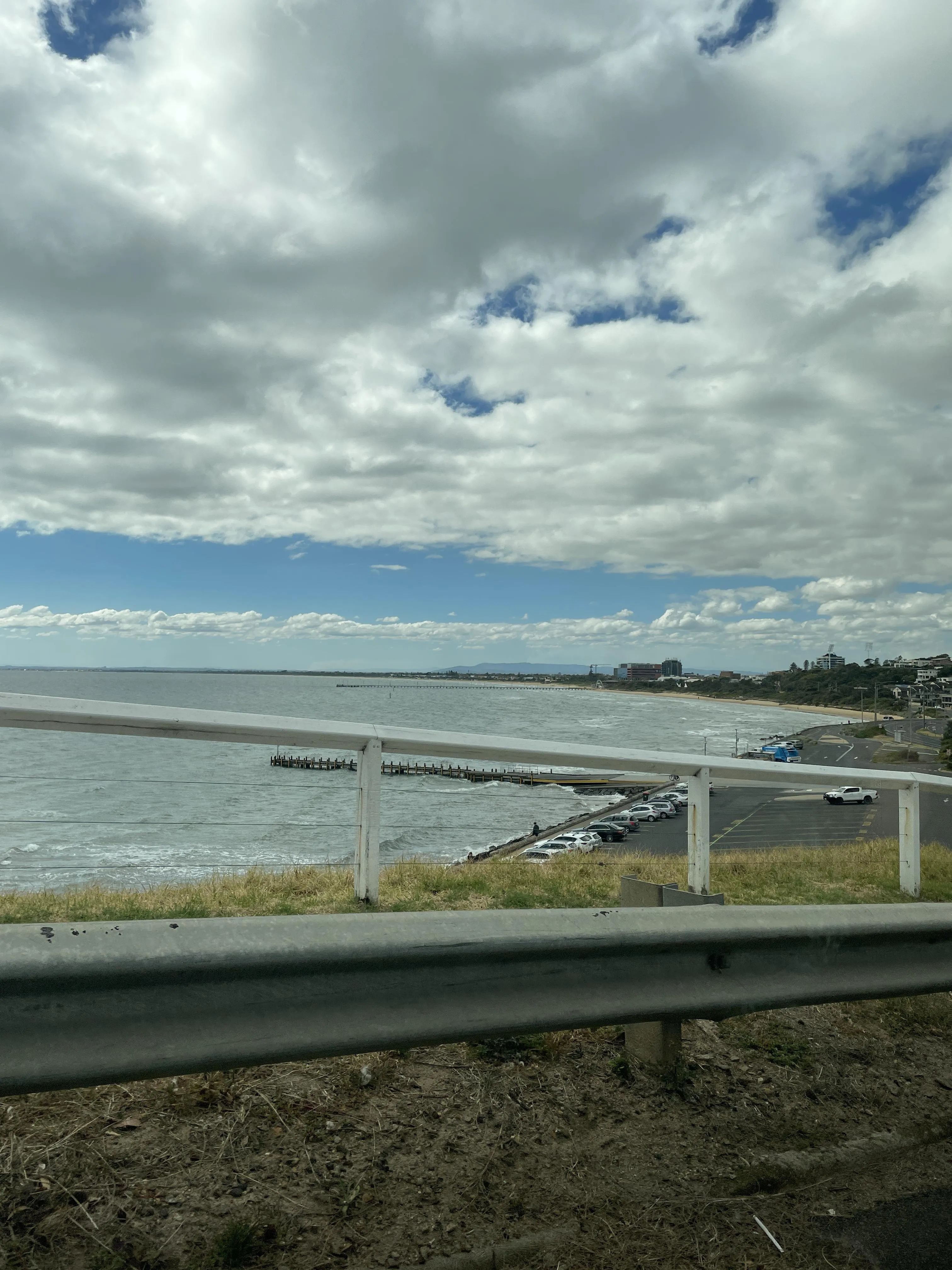
When we use exiftool with this image, we are given some coordinate headers:
GPS Altitude                    : 35 m Above Sea Level
GPS Latitude                    : 38 deg 9' 15.95" S
GPS Longitude                   : 145 deg 6' 29.69" E
GPS Position                    : 38 deg 9' 15.95" S, 145 deg 6' 29.69" E
When we put this into Google Maps. The ramp ahead is called Olivers Hill Boat Ramp.
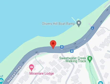
Flag: DUCTF{olivers_hill_boat_ramp}
Related Writeups
The Hidden Quest
The journey begins even before the battle starts! 🕵️♂️ In the world of knights and hackers, not everything is as it se ...
add_to_cartel
Whispers in the digital underground hint at a startling revelation about NO_NO_NO's elusive funding source. Buried in en ...
commitment_issues
The extremists are believed to be operating under a number of front companies, including Redfield Industries. Intelligen ...